Hiking

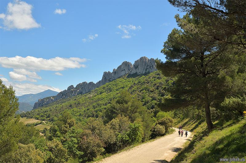
Dentelles de Montmirail with Mont Ventoux (1910 m) in the distance

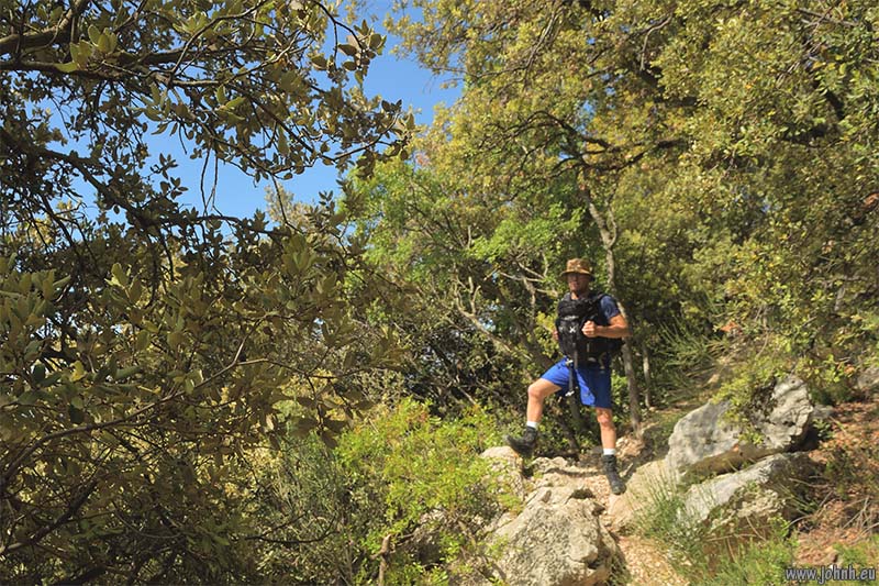
Scramble just below the crest of the Dentelles Sarrasines (627 m.)
Hiking the Dentelles, the teeth-like limestone crags above the vineyards of Gigondas and other villages of the Côtes du Rhône appellation. The climate and rocks are similar to Corsica with pines and oaks over fragrant Mediterranean flowers and herbs including thyme, chervil and savory.
The views are of Mont Ventoux (1910 m.) to one side and on the other, the far-reaching panorama of the valley of the Rhône over to the Ardèche and Cévennes ranges. We set off early-ish from the village of Gigondas, leaving behind the old stone buildings with restaurants setting up for lunchtime clients to eat and quaff under the plane trees. A brisk climb to take advantage of the morning cool, the tracks passed fields of vines terraced on the hillsides. We took the scramble up from the Col d’Alsau (445 m) to the Dentelles Sarrasines (627 m.). There was a fierce Mistral keeping the air clear but a bit of fun keeping hold of the wide-brimmed hats advised against the strong sun. Back via the Col du Cayron (195 m.).
Read more: Dentelles de Montmirail - Dentelles Sarrasines (627 m.)
Reached Scafell summit, 964 m. Car park 80 m. so quite a stomp. Not Scafell Pike. Took the interesting route via Lord’s Rake, lots of scrambling, a bit technical. Famous climbing pitches all around here. Rock hard and sharp. Only two others at summit. Down via a direct route including a scree descent below Rakes End gully. A big day; all about the climb, not the views.
More photos: Scafell summit (964 m.) via Lord’s Rake - Lake District National Park
Our atmospheric hike in the dripping mist and fog above Winsford in Exmoor National Park. The deep Punchbowl is thought to have been scooped out by glacier type actions even though it’s just south of the accepted limit of the glaciations. There’s been a lot of rain so the moss on the trees is particularly green. Mist greyout and windy on the exposed moorland up high. We passed the Caratacus Stone, which dates from the sixth century; it bears an inscription commemorating the first-century British chieftain Caratacus. Down Yellowstone Lane, today more a stream than a path but fun to run. The Royal Oak in Winsford gave us a warm welcome and an excellent lunch before we tackled the long climb back up the Punchbowl. At least the mist had cleared enough so we could see the view.
More photos: Caratacus Stone & the Punchbowl, Winsford Hill (426 m.) - Exmoor National Park
Hodbarrow haematite iron ore mine was a number of shafts close to the Duddon Estuary in West Cumbria. Two barrier walls were built using dam construction techniques to protect the workings from flooding. The mine was productive from the 1850s until 1968, a significant part of Cumbria’s mining heritage.
The enclosed area has flooded and all the workings are capped and/or flooded with almost no sign of the livelihood of hundreds of people who raised enormous quantities of high quality iron ore from the carboniferous limestone.
There are extensive sandy beaches on the coastline north of Haverigg but just one sandy beach remains at Hodbarrow Point, the sands are tinged with red from the iron ore. The area between Hodbarrow Point and Haverigg is now an RSPB nature reserve and SSSI.
Many thanks to Samuel, my guide and co-hiker

Mentone (Menton) from Punta Garavano
Our hike around the coast path from Menton-Garavan (France) to Capo Mortola (Italy), now a land and marine conservation area. This is where the granite of the Alpii Maritimi meets the azure water of the Ligurian Sea. Once the route of the Roman road Via Julia Augusta and now of railway tracks and road tunnels plus people-smugglers, the path passes a couple of small beaches and much colourful coastal scrub taking advantage of the mild (frost-free) Mediterranean climate. Various obstructions and closures made it impossible to follow the path as far as we would have liked.


