

Hiking


Hike with the BSGS in to the clouds on the PR1 path.down from the Pico do Areeiro (1818 m.). Madeira is a volcanic island but this area is described as resulting from water erosion, it is not thought to be a volcanic caldera. We'd hoped to see from above the huge Paredão valley systems that we had viewed earlier from the Miradouro da Eira do Serrado (1095 m.) but the clouds had intensified. Nonetheless, we hiked down nearly 300 m. altitude to cross a narrow ridge path not much wider than Striding Edge on Helvellyn or Crib Goch on Snowdon.

Snow on the Langdale Pikes, the Old Man of Coniston and other Lakeland peaks around Lake Windermere. A November hike from seeing the luminous dawn mist over the water from Bowness-on-Windermere via a circular route up to the classic viewpoint of Orrest Head (238 m.). for a view of the dark clouds further north and the coming sunset down the valley towards the sea at Morecombe Bay.

Leaving behind the skyscrapers of Monaco and the tiered luxury residences surveying the Baie de Roquebrune (including the famed “Cabanon” of the architect known as “Le Corbusier”) the coast path leads round the cliffs of Mount Gros (686 m.) and over rocks between the back garden gates of the Belle Epoque residences of Roquebrune and the sea-battered limestone below of the coastal rocks.
Pine trees, cacti and flowers cling naturally to the crevices in the bare rock without the concrete that retains the residences higher up.
It’s not far walking round to Menton from Monaco but a relief from the conspicuous expenditure of much of the French Riviera.
There’s a Roman tomb (dating from the 1st century BC) at Lumone on Cap Martin, the Roman way station at the junction of the Via Aurelia and the Via Julia Augusta.

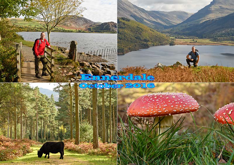
View of Ennerdale and Ennerdale Water from Anglers' Crag, known locally as Iron Crag on account of the veins of iron ore in the sides of the crag facing the lake. This was our halt for lunchtime picnic in the autumn sunshine. We enjoyed a fine hike round the lake, it's a level path on the north-west side but quite a bit of boulder-hopping on the south-west side. Plenty of granite around as well as Borrowdale Volcanics Group rocks. And here's a postcard showing more of our hike:

Magnificent clear air and views of the Mt. Blanc massif (4809 m.), also the nearby Grand Combin (4314 m.) and the Gran Paradiso peak (4061 m.) in the Graian Alps in the distance, from our hike to 2850 m. up La Chenalette to look down on the Grand St. Bernard road Pass, itself 2473 m. altitude. We enjoyed also the wildlife, including a friendly encounter with a herd of Bouquetin, grass eaters like deer but the size of small cows. More than a dozen glaciers in view at our picnic point at 2830 m. as well as lakes and the view down to the Grand St Bernard pass hospice. A rewarding hike specifically to get spectacular views,.
