Travel
I'm lucky enough to travel a lot but I also aim to understand a place in some depth. So I like to find out about the local history, sociology, wildlife and local arts. I prepare for a trip by looking up photos of the famous sights, they're usually a good guide both about the local visual interest and also a warning of what has already been done or over-done.
I try to use the tools of modern photojournalism and photography to communicate how I feel about a place. You’ll see that I have used Portrait, Street, Interior, Historical, Abstract, Landscape, Historical, Wildlife, Phone-camera and Selfie genres at different times for specific effects.
Visiting the Maeslantkering storm barrier across the river Maas, one of the tributaries of the Rhine delta. It’s difficult to comprehend the size of the huge construction, whose purpose is similar to the Thames Barrier but also allows shipping to pass upstream to the port of Rotterdam. Each of the two gates is the same length as the height of the Eiffel Tower; when swung across the channel and filled and sunk with water, they can stop an incoming storm surge from the North Sea from overtopping the dykes in South Holland. This protection wasn’t available in 1953 with the result of more than 1700 deaths and many, many homes flooded. The Maeslantkering is tested annually but has only been required to be closed once so far for real protection, in November 2007. Rising sea levels and climate change will require it to be deployed more frequently in the near future.
Low tide on the estuary of the River Adur at Shoreham-by-Sea in Sussex. The parish church of St Mary de Haura was founded around 1103 AD by Philip de Braose on his return from the First Crusade (1096–99) in Jerusalem. There’s a new footbridge over the harbour to Shoreham Beach, almost an island, with a nature reserve and beach-houses separated from the mainland by a freshwater lagoon.
Midday pause travelling in the Alpes-de-Haut-Provence. This is St-Étienne-les-Orgues and maybe you wouldn’t make a journey specially to come here. The population only just exceeds the altitude, 703 m. Michelin’s green guide mentions the church and the town as a XVI and XVII century centre of production of herbal remedies grown on the slopes of the Signal de Lure. These days that means just lavender. There’s a jazz festival in the summer but otherwise it’s a quiet place.
The Lowgill Viaduct fading in to the wet mist. It’s near the Crook of Lune and the Howgill Fells in Cumbria, familiar to hikers of the Dales Way, rail passengers on the West Coast Main Line as to road users of the M6 just before Shap Summit between Lancaster and Penrith. The Lancaster and Carlisle Railway brought railway service to Sedbergh as long ago as 1861 but the last train ran in 1964 and the railway was dismantled; the graceful red stone arches are now only used by sheep
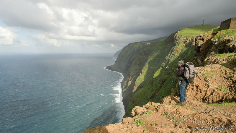
Our flight back from Funchal, Madeira, was cancelled due to fog at Gatwick so (after rebooking) we have enjoyed an excursion to Ponta do Pargo; we hiked from the viewpoint, past the lighthouse, the optical navigation aid, to see the radio tower that performs the same function for aeronautical navigation. It’s the westernmost point of the island of Madeira but not quite the most westerly point that counts as Europe, that’s in the Azores. Nonetheless there’s a lot of the Atlantic between here and Charleston, South Carolina, roughly the same latitude on the eastern seaboard of the United States.
See also Baía de Camara de Lobos; Montado do Paredão; Ilheus da Rib; Cartoon character moment In the land of dykes and sills; Madeira sunset; “One Day More”


